2014 New Year Dongshan Ride

[pe2-image src=”//lh4.ggpht.com/-JVaSQ1_1jfY/Uu8AGKCo0VI/AAAAAAAARiU/_C1cmPxrVKU/s144-c-o/IMAG2331.jpg” href=”https://picasaweb.google.com/110249026098208712655/DongshanPeakRide02#5975995336318570834″ caption=”Carrots” type=”image” alt=”IMAG2331.jpg” ]

Same ol’ story. Kids went to their aunty and uncle’s house so I went out for a ride. As I was dealing with an ample amount of time I decided against a flatland cruise and opted for the pristine beauty of the hills of Dongshan.

[pe2-image src=”//lh5.ggpht.com/-yE-2pvrrPvE/Uu8B__ySzgI/AAAAAAAARik/BqEilS9xnFY/s144-c-o/IMAG2332.jpg” href=”https://picasaweb.google.com/110249026098208712655/DongshanPeakRide02#5975997429509705218″ caption=”Farm Road” type=”image” alt=”IMAG2332.jpg” ]

I set off at about 10:30 after a short chat with the neighbors kids who are here for the holidays. They were telling me that the other kid was there because her mother had stayed up all night playing majhong so was too tired to take of her and had just left her there while she went to sleep. Hmm, kids are so damn honest, not a soul would mention the illegal gambling there, despite how blatantly obvious it is.

Gambling aside, I headed off in the wonderfully warm weather that has been dished out this lunar new year.

[pe2-image src=”//lh6.ggpht.com/-JUAnqBsoU5c/Uu8F5tHMruI/AAAAAAAARi0/xnxXWqLhssw/s144-c-o/IMAG2333.jpg” href=”https://picasaweb.google.com/110249026098208712655/DongshanPeakRide02#5976001719464406754″ caption=”Baked Sweet Potato” type=”image” alt=”IMAG2333.jpg” ]

After a long stretch I passed the familiar sweet potato guy. I really don’t know how much business he gets there, but he’s there almost everytime I pass by.

[pe2-image src=”//lh4.ggpht.com/-vzt8rdDU3HQ/Uu8Kih4iMTI/AAAAAAAARjE/D7inxkKwfsU/s144-c-o/IMAG2334.jpg” href=”https://picasaweb.google.com/110249026098208712655/DongshanPeakRide02#5976006818871259442″ caption=”Betelnut Stand” type=”image” alt=”IMAG2334.jpg” ]

In Liujia I took a slightly different route which bypassed some of the more crowded parts of the town.

[pe2-image src=”//lh5.ggpht.com/-Cx4QtlFC1ZU/Uu8K69FqjpI/AAAAAAAARjQ/DRE0a8NNtO0/s144-c-o/IMAG2335.jpg” href=”https://picasaweb.google.com/110249026098208712655/DongshanPeakRide02#5976007238490951314″ caption=”Liujia Sports Center” type=”image” alt=”IMAG2335.jpg” ]

The sports center was quite empty as the sun was out. Oh, the wonders of have the opposite thinking about sunny skies.

[pe2-image src=”//lh5.ggpht.com/-s4ZGcEopXUY/Uu8PBEtBgoI/AAAAAAAARjg/hIMp2P3Far8/s144-c-o/IMAG2336.jpg” href=”https://picasaweb.google.com/110249026098208712655/DongshanPeakRide02#5976011741660807810″ caption=”Into the Hills” type=”image” alt=”IMAG2336.jpg” ]

Shortly after I hit the foothills. The picture above was for no reason other than “here are hills”.

[pe2-image src=”//lh4.ggpht.com/-qtmMNwr5w2s/Uu8QyHz03QI/AAAAAAAARjw/z08O9Hn2h6k/s144-c-o/IMAG2337.jpg” href=”https://picasaweb.google.com/110249026098208712655/DongshanPeakRide02#5976013683819863298″ caption=”More into the Hills” type=”image” alt=”IMAG2337.jpg” ]

I took a short break to remove my shirt as I was getting quite warm and wanted to bathe in the sunshine.

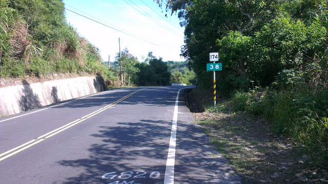
[pe2-image src=”//lh6.ggpht.com/-bKiPaurDMrE/Uu8Ro-xXIqI/AAAAAAAARj8/7mNzT2yTNlM/s144-c-o/IMAG2338.jpg” href=”https://picasaweb.google.com/110249026098208712655/DongshanPeakRide02#5976014626286412450″ caption=”174 Signpost” type=”image” alt=”IMAG2338.jpg” ]

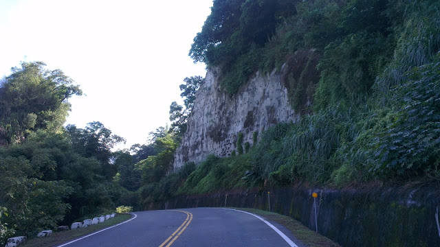
[pe2-image src=”//lh6.ggpht.com/-ecSxErZbFnw/Uu8S7KcWOTI/AAAAAAAARkM/c8DjM1IDIdw/s144-c-o/IMAG2339.jpg” href=”https://picasaweb.google.com/110249026098208712655/DongshanPeakRide02#5976016038168770866″ caption=”Cliff” type=”image” alt=”IMAG2339.jpg” ]

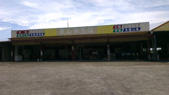
[pe2-image src=”//lh6.ggpht.com/-QP0EBsbuMmA/Uu8YOqUIddI/AAAAAAAARkg/hl-lmezTDn0/s144-c-o/IMAG2340.jpg” href=”https://picasaweb.google.com/110249026098208712655/DongshanPeakRide02#5976021870699902418″ caption=”Rest Stop” type=”image” alt=”IMAG2340.jpg” ]

I was hot enough at the rest stop to need to fill up with Super Supau. The motorbikes in the view decided that trying to slip in before the convoy of cars would be a good idea, then changed their minds and just sat in the middle of one lane waiting to get hit. Never mind that behind the convoy was completely clear, they still wanted to squeeze in. Quality of driving… sigh.

[pe2-image src=”//lh4.ggpht.com/-VC-nWmsk76U/Uu8ZAGwk9AI/AAAAAAAARks/0aa-_RpKVoM/s144-c-o/IMAG2341.jpg” href=”https://picasaweb.google.com/110249026098208712655/DongshanPeakRide02#5976022720148993026″ caption=”River” type=”image” alt=”IMAG2341.jpg” ]

The rolling hills came and went. As I ride this area more and become familiar with the hills, so the easier they become. Perhaps it is for this same reason that I ride the flats so much. They are so familiar, there are no surprises, I know how long it will take to get home, I know when the next tough climb is and when I can get some water. I also know exactly what is good about the ride, similar to watching a favorite movie again and again.

[pe2-image src=”//lh3.ggpht.com/-BS-poHqU2zQ/Uu8cCrpFXyI/AAAAAAAARk8/tY8CsWHMwRw/s144-c-o/IMAG2342.jpg” href=”https://picasaweb.google.com/110249026098208712655/DongshanPeakRide02#5976026062944296738″ caption=”Sunny, Hot and Quiet” type=”image” alt=”IMAG2342.jpg” ]

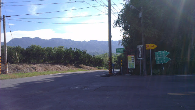
[pe2-image src=”//lh5.ggpht.com/-DshcCOg3IP0/Uu8dD2nu4_I/AAAAAAAARlI/ddkaajEvbfI/s144-c-o/IMAG2343.jpg” href=”https://picasaweb.google.com/110249026098208712655/DongshanPeakRide02#5976027182582916082″ caption=”Turnoff to main climb” type=”image” alt=”IMAG2343.jpg” ]

The turnoff to the temple signals the start of the main climbing portion of the ride. It heads up fairly steeply, but the road has been paved recently and is quite easy to zip up. The main portion to the temple took me around 20 minutes, but could be done in much less.

[pe2-image src=”//lh5.ggpht.com/-7hwafOeJryo/Uu8e3p__7CI/AAAAAAAARlY/_ogAalSh_CU/s144-c-o/IMAG2344.jpg” href=”https://picasaweb.google.com/110249026098208712655/DongshanPeakRide02#5976029172059860002″ caption=”Enjoying the sun” type=”image” alt=”IMAG2344.jpg” ]

[pe2-image src=”//lh6.ggpht.com/-AgGWk7V2oso/Uu8gK_-DwXI/AAAAAAAARlo/_5GtwiRDjtk/s144-c-o/IMAG2345.jpg” href=”https://picasaweb.google.com/110249026098208712655/DongshanPeakRide02#5976030603886444914″ caption=”Stairs for walkers” type=”image” alt=”IMAG2345.jpg” ]

[pe2-image src=”//lh4.ggpht.com/-beIcXMPfr7M/Uu8jMnhyKII/AAAAAAAARl4/lvH-tT2ckd0/s144-c-o/IMAG2346.jpg” href=”https://picasaweb.google.com/110249026098208712655/DongshanPeakRide02#5976033930220021890″ caption=”Almost to the temple” type=”image” alt=”IMAG2346.jpg” ]

The temple is when the real fun begins because there are almost no cars or people up there. Although the road to the trailhead is rough, it’s still driveable. It’s a bit of cranking in very low gears on the bike. The short burst to the flatter top section is brief.

[pe2-image src=”//lh5.ggpht.com/-hiV6bvssUTg/Uu8nBKxlPGI/AAAAAAAARmI/iZiLXXhA3hg/s144-c-o/IMAG2347.jpg” href=”https://picasaweb.google.com/110249026098208712655/DongshanPeakRide02#5976038131569605730″ caption=”Hiking Trail Map (I took the small loop just north of the You Are Here)” type=”image” alt=”IMAG2347.jpg” ]

There is trail system around here which I have never explored so today would be a good time to start. An MTB with slicks is not the most sensible choice, but is quite doable. Only the rockiest of trails are too tough to ride and those tend to be short sections.

[pe2-image src=”//lh6.ggpht.com/-eVoRQ37T5NU/Uu8pBLhWq8I/AAAAAAAARmY/mZvwBL9G1Nw/s144-c-o/IMAG2348.jpg” href=”https://picasaweb.google.com/110249026098208712655/DongshanPeakRide02#5976040330793233346″ caption=”Tiny Paved Road” type=”image” alt=”IMAG2348.jpg” ]

The path up looked quite steep but started off with quite a promising cemented section. Usually this means that someone at some time has needed to get a car up there. That also means that it will be rideable, even with only slicks. Actually a road bike should be fine too, except for the lack of low gearing (ie. you just need stronger legs).

[pe2-image src=”//lh5.ggpht.com/-64ZNwNrgqfA/Uu8rV3NKCLI/AAAAAAAARmo/psDGI6qXOKo/s144-c-o/IMAG2349.jpg” href=”https://picasaweb.google.com/110249026098208712655/DongshanPeakRide02#5976042885140318386″ caption=”Hiking Trail” type=”image” alt=”IMAG2349.jpg” ]

After passing a small house the cemented sections disappeared. But the trails that were left were wonderful. Having little gusto left in my legs I did have dismount for some rockier sections and take breaks after hard pushes. Sometimes the going is so steep that walking makes more sense and probably uses less energy overall.

An aside:

This has started me thinking how rideable these trails are for a regular (front suspension, knobbly tires) mountain bike. There are further trails to explore and it turns out that I’d picked the short “tourist hike” which has a stairway straight up from the temple below. Something for another day.

[pe2-image src=”//lh4.ggpht.com/-jzwwLRgaT2A/Uu8tgRmLFLI/AAAAAAAARm4/eWGRTJ19Fgw/s144-c-o/IMAG2352.jpg” href=”https://picasaweb.google.com/110249026098208712655/DongshanPeakRide02#5976045263046513842″ caption=”Trail Map” type=”image” alt=”IMAG2352.jpg” ]

The scale is so large that the orange loop on the map above is, by my calculations, barely a square kilometer.

[pe2-image src=”//lh6.ggpht.com/-7gWC13N8ERY/Uu8uStgsXiI/AAAAAAAARnE/-KJF4_rS28I/s144-c-o/IMAG2353.jpg” href=”https://picasaweb.google.com/110249026098208712655/DongshanPeakRide02#5976046129533181474″ caption=”Panorama from the peak” type=”image” alt=”IMAG2353.jpg” ]

From the top it’s a bird’s eye view of the hills. The clouds had come over and blocked the view somewhat, but it was good. I had a long chat with some folks at the top, and the most talkative guy suggested I should start an English school in his town and he’d invest financially. Who knows?

[pe2-image src=”//lh6.ggpht.com/-CU8F8jsKoNg/Uu86FGBe3WI/AAAAAAAARnY/oLHHaWRl-F8/s144-c-o/IMAG2356.jpg” href=”https://picasaweb.google.com/110249026098208712655/DongshanPeakRide02#5976059089734524258″ caption=”Big temple” type=”image” alt=”IMAG2356.jpg” ]

I made the dash home as I was feeling tired, the main temple came and went.

[pe2-image src=”//lh4.ggpht.com/-NXKoA2Y4BdM/Uu89_A8ouQI/AAAAAAAARno/O6UtXbf9kn8/s144-c-o/IMAG2357.jpg” href=”https://picasaweb.google.com/110249026098208712655/DongshanPeakRide02#5976063383339317506″ caption=”Not so big temple” type=”image” alt=”IMAG2357.jpg” ]

I stopped in briefly at the other, smaller temple (is there a theme developing).

[pe2-image src=”//lh4.ggpht.com/-iXSTbb4sjbE/Uu9NxK0ASJI/AAAAAAAARn8/1u0stKcQ8y4/s144-c-o/IMAG2358.jpg” href=”https://picasaweb.google.com/110249026098208712655/DongshanPeakRide02#5976080737655343250″ caption=”Resting on the road” type=”image” alt=”IMAG2358.jpg” ]

I just took in the miles, taking a rest by the road as I headed past Liujia.

I stopped at the sweet potato guy and ate two of those while on the road home, which provided some relief for my hungry tummy, although it didn’t relieve my headache. The headache was most likely from all the sun on my pale skin. Now that spring has sprung it’s time to get some rays.

[pe2-image src=”//lh5.ggpht.com/-l-S4VPCHuHQ/Uu9YHMSx1sI/AAAAAAAARoQ/ETaVprO0zj4/s144-c-o/IMAG2359.jpg” href=”https://picasaweb.google.com/110249026098208712655/DongshanPeakRide02#5976092111126255298″ caption=”Farmlands near home” type=”image” alt=”IMAG2359.jpg” ]

And, as all my rides conclude I went through the farmlands. More and more I’m avoiding the towns and  cities, I was shattered by this point, but still chose the tiny, unkept roads.

Next time around I’ll aim for the much longer trail to the south of the trailhead. It appears to be about 4km and lands up by the smaller temple above, even it becomes unrideable I can still push my bike. Preparing some appropriate footwear for walking, or just going barefoot, would be in order if I were to try that.
Zengwen Dam and Dongshan Exploring

[pe2-image src=”//lh4.ggpht.com/-AlpOe7Y5hsE/UUZeZ_1WnOI/AAAAAAAAKhY/hLmsDIJFLaY/s144-c-o/IMAG1423.jpg” href=”https://picasaweb.google.com/110249026098208712655/ZengwenDamRide#5856472166166863074″ caption=”Zengwen Dam” type=”image” alt=”IMAG1423.jpg” ]

On Sunday the family were out, so I jumped at the chance to explore some of the big hills that I’ve come to enjoy recently.

The hills have provided a great balance to the coastal cruising that is typical of my usual weekday rides. Dongshan hills are around 25km from my house, which makes them a little far for most weekday rides.

Anywho, it was time to time to get out so I jumped on my bike at around 11:30 to start the cruising. The sun was out, it was hot and an absolutely glorious day for a ride.

At 5km in, I got a puncture.

The power of focus is great. It’s something I lack in any task which I do not enjoy or feel motivated, and when I’m on my bike, I feel both. With the hills in my mind, I whipped off the wheel as a matter of process, inspected the tube, found the leakage was under and old patch, and decided that using my other tube with a puncture would be better.

Out came the old tube. I fixed it’s puncture and put the wheel back in.

I guess around 10 minutes including glue drying time.

And off again.

[pe2-image src=”//lh6.ggpht.com/-WZIGwAHgoYo/UUZfD8ocO_I/AAAAAAAAKjg/5iVXGhgz74Y/s144-c-o/IMAG1441.jpg” href=”https://picasaweb.google.com/110249026098208712655/ZengwenDamRide#5856472886861904882″ caption=”View from a hill” type=”image” alt=”IMAG1441.jpg” ]

The intense heat while changing my tube should have alerted me to the oppressive humidity of the day as I was sweating profusely when I got back on the bike. Nevertheless, I was off again, back on the aerobars and cruising towards the hills.

Just after passing through the most populated section of the route I stopped to remove my cycling shirt so that I could bask in the big sun while riding. Then back on the aerobars and more cruising.

Sporting a naked top half I decided to do a slightly longer route around Liujia so as not to cause any accidents while scooter riders plough into each other while they’re fixated on my shiny, white exterior.

Then onto the hills.

On considering this route for the weekend, one of my biggest concerns is the hordes of heavy motorbike riders that like these hills.

I could go on and on about the complete lack of basic road skills here in Taiwan. I could also ramble about how scooter riders are the most inept fools on the road, second only to bicycle commuters, except that they sport speeds at least 3x that of the daily cyclist here. Now take that complete ineptitude, add some body armor, a bike with an engine 5x that of a scooter and the price of a sedan, and you have death on wheels. These guys think they are so bloody cool, but in reality, they’re idiots just like they are on their scooters the rest of the week. Their stupidity is simply multiplied. Random lane changing, constant swerving across lanes, specifically passing on blind corners, most notably in the places where I saw tons of “Dangerous Section of Road” signs.

Admittedly these guys are not all assholes, and apologies to those who take road safety seriously, but there are a huge number who are morons. So much for the beauty, peace and quiet of the countryside. Sigh.

Time to find alternate roads.

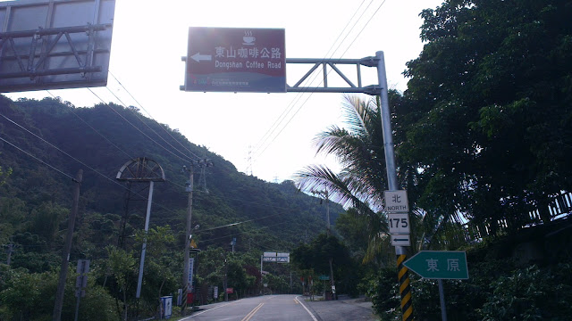
Anywho, I followed the 174 all the way out, passed on by the 175 coffee road and on to the turnoff to the dam.

From here, traffic would be light.

[pe2-image src=”//lh6.ggpht.com/-Ms8Ng9BrWus/UUZebkUZQaI/AAAAAAAAKhg/eX8oTh_JyDs/s144-c-o/IMAG1424.jpg” href=”https://picasaweb.google.com/110249026098208712655/ZengwenDamRide#5856472193140605346″ caption=”Slipway” type=”image” alt=”IMAG1424.jpg” ]

To my surprise there was an entrance charge for heading into the dam area. I decided it was worth it, and put the fee down to my lack of experience in this part of the world. No wonder there was no Google Street View footage of this area. I was heading towards other roads that would head straight over the hills and my exploring would allow me a cost free route next time around.

The runup to the dam is nice enough. It’s a really wide road, that looks like it was made specifically for lots of tourists and busses. Thankfully there were no busses on the day. There’s a fancy looking visitor center which I whizzed straight past. I would rather just stay on my bike.

Even when out exploring I tend to pass by most fixtures that attract lots of people. This does mean that I miss out on some things. Somehow I believe it’s the better choice, but in reality it’s just a choice. Duh.

The beauty of the ride is in the exploration. Finding new places, doing new things, going where no man (well, at least I) has gone before. Visitor centers are created for tourists, not explorers. I would rather spend a whole hour just sitting up on the hill looking out on the glorious beauty of the natural world than in a visitor center. I’d rather be sweating out in the sun, than sitting on my ass watching a TV presentation. In my own reckoning, the true beauty lies not in what some other person can create for me to see, but in what is already there.

I digress.

The road leads all the way up to the dam wall, but along the climb I noticed a big, red sign welcoming people to a temple in the hills. The leadup was a very steep, concrete paved road. I took mental note, passed on by and headed to the top of the dam wall.

[pe2-image src=”//lh4.ggpht.com/-PHIAzoq1Hlo/UUZektRvN7I/AAAAAAAAKiI/kNiQZd_qERo/s144-c-o/IMAG1429.jpg” href=”https://picasaweb.google.com/110249026098208712655/ZengwenDamRide#5856472350164203442″ caption=”You will not pass!” type=”image” alt=”IMAG1429.jpg” ]

The obligatory picture taking got done quickly, but I was a little disappointed to find no entry signs on the way to the route I was hoping to take up the hill. I’ll happily pass by the no entry signs when no-one is around, but I’m not such a rebel when others are looking on. Just me, but there you go.

I enquired with the security guys as to how I could get over the hill and they told me that the road by the red sign I had seen was the way to go.

[pe2-image src=”//lh4.ggpht.com/-1jEPHW1zHXI/UUZeeJSlfTI/AAAAAAAAKho/3vcUpMEHays/s144-c-o/IMAG1425.jpg” href=”https://picasaweb.google.com/110249026098208712655/ZengwenDamRide#5856472237424868658″ caption=”Behind the wall” type=”image” alt=”IMAG1425.jpg” ]

Instead of heading straight there I continued on over the wall and followed the route that overlooks the dam and leads to the no. 3. This section of road was pleasant enough, climbing a bit until I did hit the no. 3, then checked my maps and headed back to the dam wall. And the climb from hell.

[pe2-image src=”//lh4.ggpht.com/-3hWwNl-OQ7Y/UUZetsujqeI/AAAAAAAAKig/wg7f9qmFhew/s144-c-o/IMAG1432.jpg” href=”https://picasaweb.google.com/110249026098208712655/ZengwenDamRide#5856472504635468258″ caption=”The alternate route” type=”image” alt=”IMAG1432.jpg” ]

I was hoping for a hard climb, and boy, did this one ever impress. I’m always surprised at just how steep Taiwanese can build their roads.

As I started on the upward journey, I went straight into granny gear. That’s a 22×25 in case you’re wondering. I wouldn’t change down until very much further up the hill.

[pe2-image src=”//lh6.ggpht.com/-9uNw5rR1u0w/UUZe0TZ2MuI/AAAAAAAAKiw/-cTEIhOnIeA/s144-c-o/IMAG1435.jpg” href=”https://picasaweb.google.com/110249026098208712655/ZengwenDamRide#5856472618096800482″ caption=”Mini Dam” type=”image” alt=”IMAG1435.jpg” ]

The first steep bit landed me next to a small dam, which on any other day would likely have served as a picnic spot. Being my silly self, I hadn’t packed any food so I just stopped for pics and then hit the wheelie inducing climb again. There were constant sounds of animals running away as I headed up the road. Monkeys in the trees, while squirrel-looking things scurried away as the new visitor approached.

But it was here that I started to suffer.

[pe2-image src=”//lh4.ggpht.com/-TBxPKq2kj_c/UUZe24ymD3I/AAAAAAAAKi4/_dmhH0Lvjf8/s144-c-o/IMAG1436.jpg” href=”https://picasaweb.google.com/110249026098208712655/ZengwenDamRide#5856472662492450674″ caption=”Steep! Taiwan style.” type=”image” alt=”IMAG1436.jpg” ]

My last meal was the previous evening at around 18:00, and I hadn’t (as usual) had breakfast in the morning. This is nothing special, except that this ride was straining me more than I had expected and the humidity was intense. Although the humidity is pretty high a lot of the time, it is amplified when is the hills between thick clusters of trees and bushes.

My shirt was drenched, despite being completely open at the front (I had put it on after getting plenty of sunshine).

I was taking the hill in segments, I’d push myself to ride to the next switchback, then stop for a moment and continue. The sweat was pouring down my head and I was running out of water.

Energy reserves: zero.

[pe2-image src=”//lh3.ggpht.com/-3h6tEXUgQc4/UUZe9Xwbj0I/AAAAAAAAKjI/5w_xLiOHqBI/s144-c-o/IMAG1438.jpg” href=”https://picasaweb.google.com/110249026098208712655/ZengwenDamRide#5856472773884088130″ caption=”My bike taking a rest” type=”image” alt=”IMAG1438.jpg” ]

At one point I sat down at the side to completely cool down and enjoy the slight breeze that was blowing through the hills. It didn’t help get my energy back, but did relieve me from the heat. The views are breathtaking. The hills of Taiwan are lush and green and a sight to see for sure. Always are.

After getting myself back in shape I headed on up through the final sections.

One scooter passed by and listening as it weaved it’s way up the hill and the varying screeching from it’s diminutive engine gave me hope that I was nearing the peak. And it was so. The road flattened out, I got into the middle chainring and pressed on.

Finally I spotted the trailheads at the top and recognized where I was.

I had to eat. NOW.

I checked my maps and plotted my course for the nearest 7-11. I love 7-11 not because of the gourmet food, but the cookie-cutter consistency of their stores. No matter which one you pick, it’s always the same goop, good goop, yucky goop, but always the same.

After plummeting down a few hundred vertical meters I was greeted by what will likely become my new alternative road in these hills.

[pe2-image src=”//lh5.ggpht.com/-8kJp5S7qWPc/UUZfKPn2XfI/AAAAAAAAKjw/J6ntM4CygUM/s144-c-o/IMAG1443.jpg” href=”https://picasaweb.google.com/110249026098208712655/ZengwenDamRide#5856472995038911986″ caption=”Houses on the hill” type=”image” alt=”IMAG1443.jpg” ]

Nicely paved, few cars or scooters and a consistent grade. But that’s for next time.

I pressed on, hoping for the absolute minimum of hills as I was feeling pretty faint. Just keeping the intensity down to what was necessary. It was a flattish cruise and after a brief “Where the hell is the 7-11?” moment I saw it around the corner, with it’s familiar green glow beckoning me to go and stuff myself.

My guess is that I got 3000 Calories of food in that single session. A great excuse to pig out. Three chocolates, a curry and rice, dried mangoes, baked potatoes, Fruitips, a slice of pizza, a small milk and some other bits and bobs. Yum!

The final leg of my trip had to be made quickly. I had used up a lot of time with rest stops and contemplating routing details and the previous big hill that had slowed progress drastically.

Final hill was soaked up fairly quickly, it’s short and quick.

Then the 30km flat stretch.

5km of tucked in cruising done and I was starting to experience a new sensation that I have not really experienced before.

Cramping.

Not like I haven’t felt my legs start to tense up, but never anything so serious that a mild stretch wouldn’t sort out. I stopped to stretch, hoping that would solve it. Usually a short stretch is all I need and it gets the yuckiness out of my legs.

But nope.

A kilometer later and they were back with a vengeance. I tried to flick my leg back to stretch my quads while on the bike, but then my hamstrings started, I tried the other side and the same thing happened. I stopped and both legs almost seized up while swinging my legs over the bike in the most awkward way I could to avoid the muscles tensing up. This was a much more thorough stretching session and helped me to get another half hour before needing to stretch out again.

I then managed to get all the way home without further incident, just watching how much I exerted to avoid the obvious consequences.

And at around 19:00 I was home. Ready for a good shower and ready to continue stuffing my face, which I did like a trooper. I won’t give you the nitty-gritty, but I will tell you that it involved ice-cream and cones.

Another good day. Done.

[pe2-image src=”//lh3.ggpht.com/-x-inFVV6FFs/UUZegNI0ydI/AAAAAAAAKh4/cohEn1Sry2c/s144-c-o/IMAG1427.jpg” href=”https://picasaweb.google.com/110249026098208712655/ZengwenDamRide#5856472272817408466″ caption=”A good ride” type=”image” alt=”IMAG1427.jpg” ]

Exploring Dongshan Mountain Coffee Road in Tainan

IMAG0879.jpg
The View From a Peak Above Route 175

I had the morning off work, so with the kids at school and around four hours on my hands I set to exploring.

I have been keen to explore the mountains around Tainan. This hasn’t been hugely successful in the past, but I was determined to make it work out this time.

Alishan was one of the first I found. After riding up Alishan I had found that the ride to Jiayi City and the base of those hills was only around 50km from my front door. That is doable in 2 hours along pretty quiet roads.

The problem is that is still four hours of commuting time simply getting to the hills which doesn’t make it easy to get out and climb if you really want to.

IMAG0861.jpg
The Road Into The Hillside

The other one is the route to the southern cross-island highway. This route is, unfortunately, quite sucky. It involves a lot of traversing through towns and traffic lights and once you hit the hills they are really not all that pretty or inviting. It takes a long while to get to the awesome parts of that road. Maybe I’m picky, but if the hills are sucky, I’d rather just ride the flats. The southern cross has wonderful dramatic scenery with mountains plunging straight down into the rivers below, but if takes a good 80km or more to get to that good stuff.

An adult student of mine told me of an area quite close by that he said was both beautiful and quiet, a sacred combination in Taiwan, and another friend of mine had mentioned the area before too, so I searched around for the roads of Google maps and then headed off.

The route starts with a quick 10 minutes flat along my least favorite road to the nearby town of Madou, most famous for the scrumptious pomelos that I am so happy to gorge down on when that time of year comes around.

I have come to deal with the unpleasantness of this bit, and find that it now passes by quite effortlessly. Once through this town it’s quiet country roads, heading in a North-Easterly direction. All flat and quick going.

IMAG0862.jpg
Steep Cliffs Along The Roadside

After passing through the small town on Liujia, I quickly arrived at the hills. Just 28km of flats and I was into the luscious green tree-lined roads that so epitomize Taiwan’s most beautiful mountain roads.

It slowly dawned on my that I had ridden these roads before, about 10 years ago, and they started fitting together like the pieces of a half-forgotten dream.

I continued climbing at a moderate pace in preparation for the much bigger climb I knew was waiting. The road twisted and turned, and rose and dropped gently enough to give me respite on the downs and not tax me on the ups.

IMAG0864.jpg
Alternative Roads for Exploring

Unlike the last time I was on these hills, I had a better idea of where to find the good stuff. Although modern technology has removed a lot of the element of surprise from most journeys, it has also opened up the way for finding the biggest and highest routes without exploring every road and without resorting to paper-based contour maps. Google Maps is my tour guide.

IMAG0866.jpg
Turnoff to Dongshan Coffee Road
IMAG0867.jpg
Butt-Ugly Rest Stop

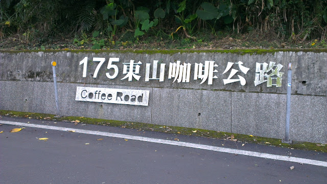
So at the butt-ugly rest stop I hooked a left onto the Dongshan Coffee Road, Tainan’s route 175. I was expecting endless lines of coffee shops but was actually greeted by nothing. A pleasant surprise, I have to say. I later found out that the vast majority of the coffee shops are in the vicinity of the huge temple on the hill. Not too surprising.

IMAG0869.jpg
Coffee Road

This road looked promising for further exploration, heading toward Guanzilin and Baihe, and being in close vicinity of a number of roads leading down to quiet rivers and the like. But today, my plans were taking me upward.

I was keeping my eye out for the climb to the top, but when I got to the first notable intersection I had already passed it.

IMAG0870.jpg
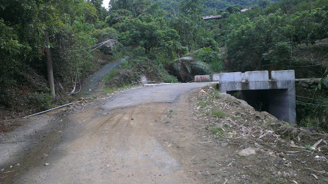
The Dusty Start

I backtracked and found the actual route to be a road possibly too narrow and too steep for a car. This was a slightly ominous sign, but with nothing to lose, and just fun on the menu, I just pressed on.

IMAG0872.jpg
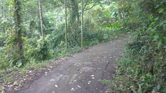
Hardly Ever Used

As it turns out, Google Maps doesn’t quite differentiate between road sizes. What I ended up on were concrete strips heading directly up the hill. I was straining to keep upright while pommeling away in granny gear.

At one point I was following the concrete strip but had to backtrack (again) and take a path that was just dirt, but then connected up with concrete again.

IMAG0874.jpg
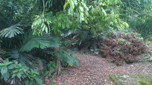
Very Unused Road/Path

After plodding along for a little further I got to a road that looked like it might have been used by scooters at least a handful of times in the past year and after a last slippery section I popped out at a fully-fledged road.

I had inadvertently taken the road straight up rather than taking the twisting, turning route up.

IMAG0875.jpg
Signs of Civilization

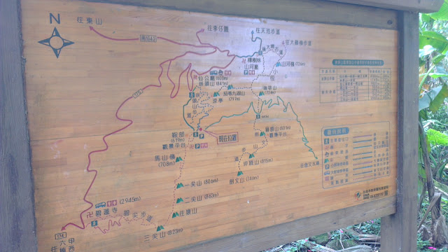
A quick , short, flattish section brought me to the crossroads of a few walking trails. These trailheads are often very well concealed and I was happy to find these and with a little more time can explore further into the hills. The detailed map shows where the paths head to. These all head to the top of the hill, or along the mountain range to who knows where. Trails for exploring.

IMAG0876.jpg
Map of the Local Trail Network

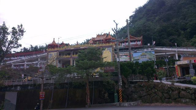
So after some quick pics and avoiding a few very nasty wasp-like things I headed back on down the hill. This time I followed the main road. Passed the huge temple, cruised on down for 300 vertical meters and was then back on the coffee road for the trek home.

IMAG0878.jpg
Big Temple in the Hills

I have to make a shout out to Corne who had mentioned these roads before. I had come to believe that Tainan was without any hills but as it turns out they are only a short hop from my front door. Less than an hour with a bit of a push.

All photos of Dongshan Mountain Coffee Road in Tainan ride on Picasa.